
The 1896 East Coast Hurricane
The 1896 East Coast hurricane was a slow-moving tropical cyclone that battered the East Coast of the United States from Florida to New England in mid-October 1896. The fifth tropical cyclone of the 1896 Atlantic hurricane season, it formed on October 7 in the southern Gulf of Mexico, and caused minor damage in Florida while crossing the state two days later. From October 10 through 13, the hurricane drifted northeastward along the coast, reaching its peak intensity as the equivalence of a Category 2 hurricane on the modern-day Saffir–Simpson scale. The hurricane subjected many areas along the East Coast to days of high seas and damaging northeasterly winds, which halted shipping operations.
Impact of the Hurricane
The Mid-Atlantic coastline experienced flooding storm tides that submerged and heavily eroded Cobb’s Island, part of the Virginia Barrier Islands. Hotels and cottages there were extensively damaged, and the hurricane brought about the end of the island’s stint as a popular summer resort. Along the Jersey Shore, low-lying railroads were flooded, boardwalks were destroyed, and many beach houses sustained damage. The hurricane did $200,000 in damage to coastal installations on New York’s Coney Island. To the north, wind gusts as high as 80 mph (130 km/h) affected eastern New England. Four sailors died in two maritime incidents attributed to the hurricane, and overall damage amounted to $500,000.
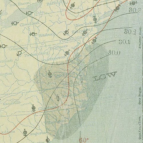
Meteorological History
The fifth documented tropical cyclone of the 1896 season was first noted in the southern Gulf of Mexico as a weak tropical storm on October 7. It tracked toward the east-northeast and made landfall in a sparingly populated region of Southwest Florida around 00:02 UTC on October 9. The storm crossed the Florida Peninsula and emerged over open water near Sebastian. Turning more northeastward, the storm gradually intensified and achieved hurricane intensity on October 10. By that evening, hurricane warnings were hoisted along the East Coast of the United States from Jacksonville, Florida to Boston, Massachusetts.
The unusually slow-moving hurricane attained its peak intensity early on October 11, with estimated maximum sustained winds of 100 mph (155 km/h). Shortly thereafter, it made its closest approach to Cape Hatteras, North Carolina, passing roughly 115 mi (185 km) to the southeast. For several days, the hurricane brushed the coast from Virginia to southern New England with hurricane-force wind gusts. The storm began to weaken as it slowly gained latitude. Unseasonably cool temperatures were recorded in New York City as the system passed offshore, suggesting that it had begun losing its tropical characteristics. By 00:00 UTC on October 14, the storm completed its transition into an extratropical cyclone, and no winds stronger than tropical storm-force were observed north of 41°N. A little over a day later, the hurricane’s extratropical remnants struck the coast of central Nova Scotia before dissipating on October 16.
Impact on Florida
The relatively weak storm caused little damage upon landfall in Florida, though some coastal flooding occurred near Punta Gorda. An apparent tornado north of the storm’s track destroyed a home and an outbuilding. Northeasterly gales and high tides affected northeastern portions of the state, including Fernandina, where lumber docks were flooded and parts of the Florida Central and Peninsular Railroad were washed out. Street flooding also plagued St. Augustine, but no major damage was reported there.
Impact on North Carolina
Strong northerly gales affected the Outer Banks of North Carolina for three days, peaking at 72 mph (116 km/h) in Kitty Hawk on October 11. Winds reached 70 mph (110 km/h) along the Virginia Capes and 40 mph (65 km/h) farther west at Norfolk. Just inside the capes, a cargo ship called the Henry A. Litchfield ran aground on October 12. Storm surge flooding inundated the Cape Henry Light keeper’s house and washed away telegraph poles, while severe damage was reported in Virginia Beach.
Impact on the Virginia Barrier Islands
The storm inundated the Virginia Barrier Islands, completely covering Cobb’s Island, a popular summer resort, to a depth of at least 1 ft (0.30 m). Pounding waves, reportedly 40 ft (12 m) high, crushed some cottages and partially buried others in sand, while depositing numerous boats in the middle of the island. United States Life-Saving Service crews rescued two women in imminent danger of being swept out to sea. As waters rose, residents fled to the upper stories of their homes to await rescue by lifeguards. The Cobb’s Island Hotel was a complete loss, and almost every building on the island sustained some degree of damage.
Further Damage Along the Coast
Along the coast of Delaware near Cape Henlopen, the schooner Luther A. Roby was driven aground and broken up by the pounding surf. Three crew members died in the wreck, and five others safely reached shore with the help of rescue workers. The worst effects were observed along the Northeastern shoreline from New Jersey to New England. In these areas, coastal flooding and persistent gales inflicted an estimated $500,000 in damage to beachfront property.
Conclusion
The 1896 East Coast hurricane was a significant meteorological event, causing widespread damage, loss of life, and long-lasting impacts on the affected regions.