
‘Atara: A Historical Overview
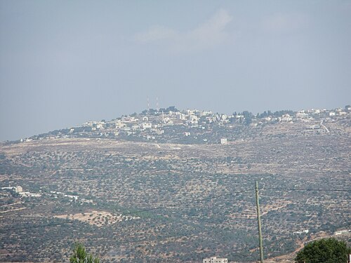
‘Atara (Arabic: عطارة ‘Atâra) is a significant Palestinian village located in the Ramallah and al-Bireh Governorate, 15 kilometers north of Ramallah in the central West Bank. Nestled along a mountain ridge line, it stands on the second highest point in the West Bank at an elevation of 810 meters above sea level. The village encompasses a total land area of 9,545 dunams, predominantly suitable for agriculture.
Geographic Location
‘Atara is situated 10.7 kilometers (6.6 miles) north of Ramallah and is bordered by Silwad to the east, ‘Abwein to the north, Burham, ‘Ajjul, and Umm Safa to the west, and Bir Zeit to the south.
Historical Significance
Archaeological findings indicate that sherds from the Iron Age I, Iron Age II, Persian, Hellenistic, Roman, Byzantine, and Mamluk eras have been discovered in ‘Atara. Edward Robinson identified ‘Atara with the Biblical Ataroth mentioned in the Book of Joshua. Nevertheless, some modern scholars suggest an alternative location for Ataroth.
Ottoman Era
In 1517, ‘Atara became part of the Ottoman Empire. By 1596, the village appeared in tax registers, reporting 55 Muslim households who paid a tax rate of 33.3% on various agricultural products, amounting to 4,300 Akçe. Over the centuries, ‘Atara remained a Muslim village, with its population fluctuating.
British Mandate of Palestine
During the 1922 census, ‘Atara had a population of 407 Muslims, which rose to 559 by 1931. The Jewish National Fund established a moshav known as Ataroth in 1922, contributing to the complex demographic changes in the region.
Jordanian Era
Following the 1948 Arab-Israeli War, ‘Atara fell under Jordanian rule, with a population of 1,110 recorded in the 1961 census.
Post-1967 Developments
Since the Six-Day War in 1967, ‘Atara has been under Israeli occupation. The 1967 census recorded 903 residents. The Oslo Accords designated 40.8% of village land as Area A, while 43.8% is classified as Area B, and 15.4% as Area C. A total of 163 dunams have been confiscated by Israel for the construction of the Israeli settlement of Ateret.
Cultural Heritage
‘Atara is home to two significant sanctuaries: the old mosque encasing the Sanctuary of I’mar and the maqam of Sheikh al-Qatrawani, a historic shrine located on the Dahrat Hamoud hill.
Demographics
Population trends in ‘Atara have shown fluctuations, with emigration impacting growth. By 1997, the population reached 1,661, with the gender ratio almost equal. More recent estimates indicate around 2,492 residents in 2017.
Economic Overview
Historically, ‘Atara’s economy relied heavily on agriculture. However, after 1967, many residents sought employment in Israel, leading to a decline in agricultural production. The village is known for its egg farms and olive cultivation, though Israeli checkpoints and land confiscations have strained its economy.
Conclusion
‘Atara stands as a testament to the rich historical and cultural tapestry of the West Bank, reflecting the ongoing challenges and resilience of its inhabitants.